By Jeremy Patton
Bee Rock Loop Trail #529 is located in Bee Rock Recreation Area in Daniel Boone National Forest, Pulaski County, Kentucky.
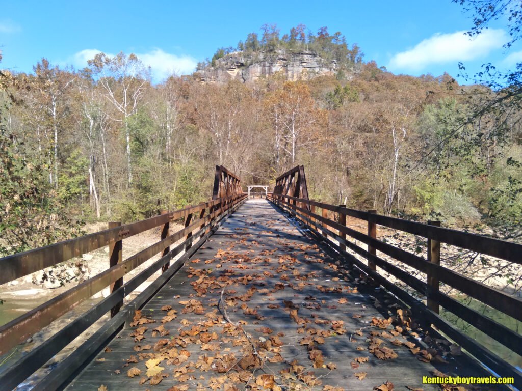
From London, drive west on KY-192 until you come to the bridge that crosses the Rockcastle River. Before crossing, turn right to enter the west side of Bee Rock Campground. Follow the paved road until it comes to Old Sublimity Bridge (foot travel only). There are several parking spots near the bridge.
This article will direct you to Bee Rock Loop Trail from here, but there is an alternative when parking is scarce. Return to KY-192 and drive over the Rockcastle River. Turn right immediately after the bridge to enter the east side of Bee Rock Campground. Follow the paved road until it meets gravel then continue until it dead-ends at the gravel parking lot.
The east campground and parking lot are closed during winter.
Step onto Old Sublimity Bridge and look straight ahead for a grand of view of Bee Rock. Bee Rock Loop Trail will lead you to the overlook where you can peer back down at where you are now standing.
Crossing the bridge provides a calm view of the Rockcastle River. A short hike up-river via the Rockcastle Narrows Trail #503 brings you to an angry stretch of rapids where many kayakers have drowned.
Cross Old Sublimity Bridge then turn left, following the paved road. Walk approximately 0.2 miles until you reach Trail #529. This is one of two trail-heads, the second located in the opposite direction, closer to the gravel parking lot. Do not depart there because it will make the journey more steep and difficult.
Bee Rock Loop Trail is one of my favorite hikes. There are many interesting sights packed into this 2.2 mile trek: forests, cliffs, caves, peculiar rock formations, an overlook and four waterfalls.
Proceed up the wooden steps. The path gradually ascends north into the forest. Gurgling streams and slump rocks abound as Trail #529 penetrates the cliffs. It veers north-east at about 0.4 miles then a large rock shelter and small waterfall appear to your left.
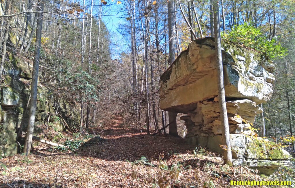
Back on the trail and perhaps 50 yards from Waterfall #1 stands, what I have dubbed, Table Rock. A friend of mine who grew up in the area informed me that this section of the trail was once a logging road. As you examine this odd yet beautiful rock formation, ask yourself “is it natural or is it the result of dynamite?” I do not know but I hope that it is the former.
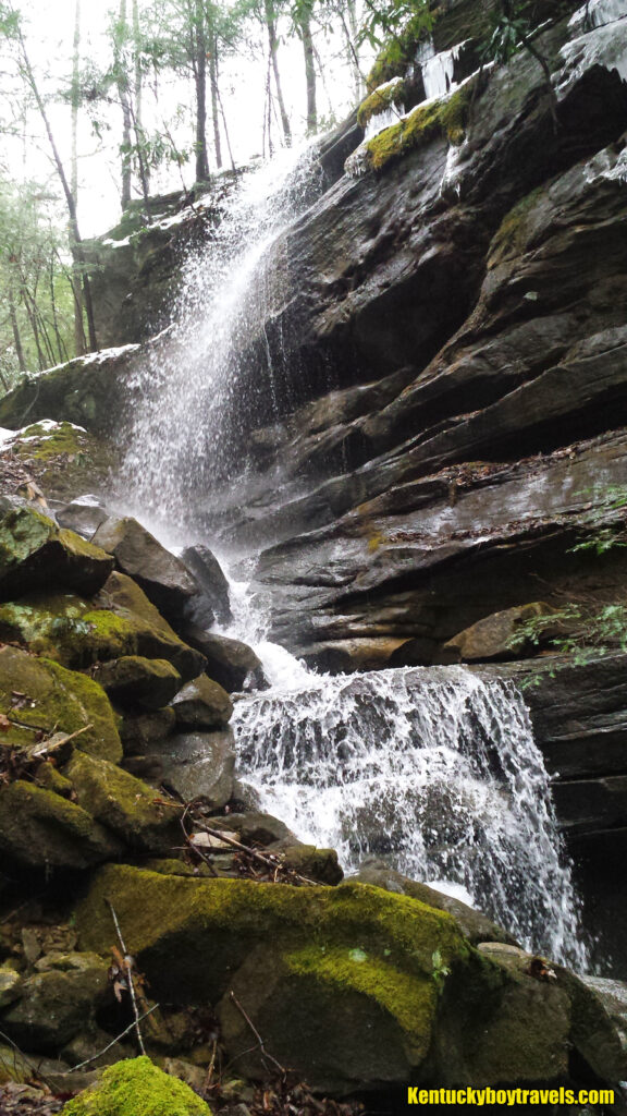
At 0.5 miles, Waterfall #2 streams down a ledge to your right. It is more impressive than the first, but as always, the strength of a waterfall is affected by recent precipitation. If you are adventurous, climb down the adjacent ledge and view the falls from below.
Travel uphill for about 0.25 miles then turn right over a small foot bridge. As you head east toward the top of the ridge, the forest opens up, the sun shines brighter and the wind blows harder. The trail becomes more obscure. You should have no trouble staying on course as long as you pay attention. Watch for markers on the trees and sawed logs that have been rolled to the side.
The trail haults at a “T” after another 0.25 miles. If you turn left you will arrive at the junction of Rockcastle Narrows Trail #503. Do not take this route unless you want to leave Bee Rock Loop Trail and add about two miles to your hike. The junction is marked with a steel stake.
Turn right to continue on Bee Rock Loop Trail. The path meanders south through the forest for about 0.75 miles. #529 splits and you must choose whether to go straight to the overlook or turn left to descend the cliffs.
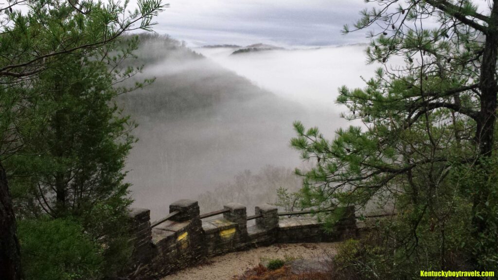
Go straight and enjoy the panoramic view of the Rockcastle River and surrounding cliffs. The overlook sits about 1000 feet above sea level. You can easily spot the KY-192 bridge, Old Sublimity Bridge and parking area. This is a great place to rest and eat a snack.
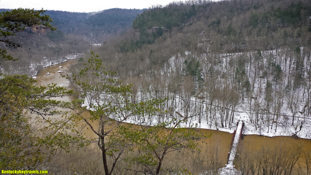
Retrace your steps then turn right to resume the loop. Be cautious on this segment because there are numerous opportunities to plummet to your death. As you descend, admire the cliffs as they tower higher and higher above you. Study the exposed strata and marvel at the ancient geological history of the area. One particular stratum is saturated with pebbles, evidence that long ago this area was submerged. That is my interpretation, but I am no geologist. I would certainly like one to accompany me on this trek in the future.
Shadows deepen, the air gets cooler and you hear water slapping against stone. Traverse a rotting set of planks over a stream then enter a large cavern. The trail passes through it, exiting out the back where a waterfall plunges from a break in the cliff. Waterfall #3 is thin, so you should be able to pass around it without getting wet. If there has been lots of rain, prepare to get soaked.
After emerging from the cavern, the final segment moves south for approximately 0.5 miles. It is mostly a gentle descent to the paved road, but there is one more surprise waiting, if you are willing to go off-trail. The way to Waterfall #4 is difficult and should not be attempted unless you are in shape. Furthermore, the chances of getting snake-bit increase, so watch where you step.
As you make your way down-trail, listen for crashing water to your left and follow your ears. Move uphill, negotiating thick underbrush and boulders as the sound intensifies. Round a final group of massive slump rocks and you will see water flying from atop the ridge. It is a thin but strong waterfall, perhaps 60 feet (I am not good at judging heights). You can climb up to a ledge at about midway and stand under the falls. The small patch of grass growing there is an otherworldly shade of green in spring. If you visit on a sunny day, at the right moment, a rainbow appears on the ledge or at the bottom of the falls.
The distance off-trail is not more than 0.2 miles. Admittedly, I passed by Waterfall #4 numerous times before discovering it. It is far from the trail, so your best chance to hear it is after heavy rain.
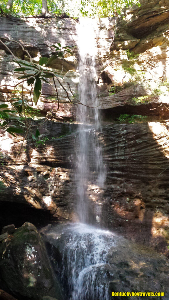
When you arrive at the paved road, turn right to return to Old Sublimity Bridge. Cross the bridge, peer over your shoulder and behold majestic Bee Rock one more time.
The loop is complete.
****
On 2/17/16, I left Bee Rock Loop Trail near the overlook and followed the cliff-line east, where I located the crests of BRF #3 and BRF #4. Just upstream from BRF #3, I discovered a second, smaller waterfall that I call Bee Rock Falls #3B. Some intriguing rock formations decorate the wall just before the stream leaps into the cavern.
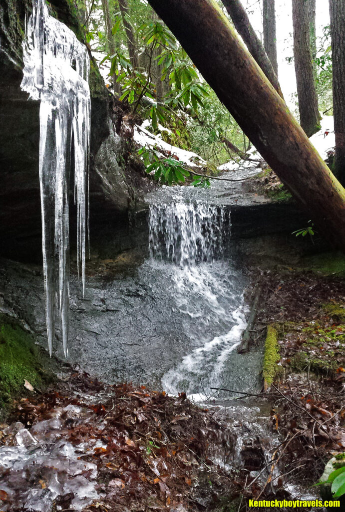
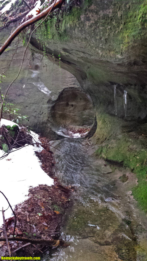
I do not know what possessed me to do this off-trail, cliff-edge trek while the forest was blanketed by snow and ice. It was not one of my smartest spur-of-the-moment decisions. With that said, I carefully minded my footing and dared not venture too close to the edge. You might be able to get closer during dry weather.
I plan to continue exploring the bluffs east of BRF #4. The undergrowth became insufferable, prompting me to turn around on this day.
****
10/3/18 – I fled to the woods last Friday to escape the World Chicken Festival. My hiking season usually starts when the weather gets cold and the parasites retreat, but I might have made it home unmolested if I had remained on the trail. I am now itching and paying the price.
The ground was saturated and the waterfalls strong. I paused near Waterfall #1 and remembered the time I lead my mother there. She liked the spot.
I climbed below Waterfall #2 for photos. I gazed at its adjacent rock shelter and decided to finish exploring it this winter.
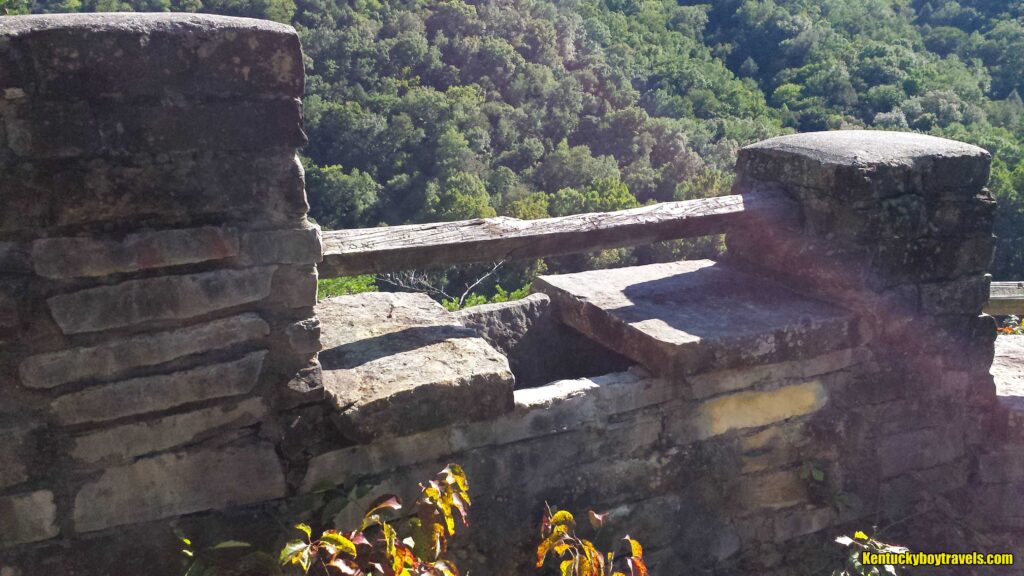
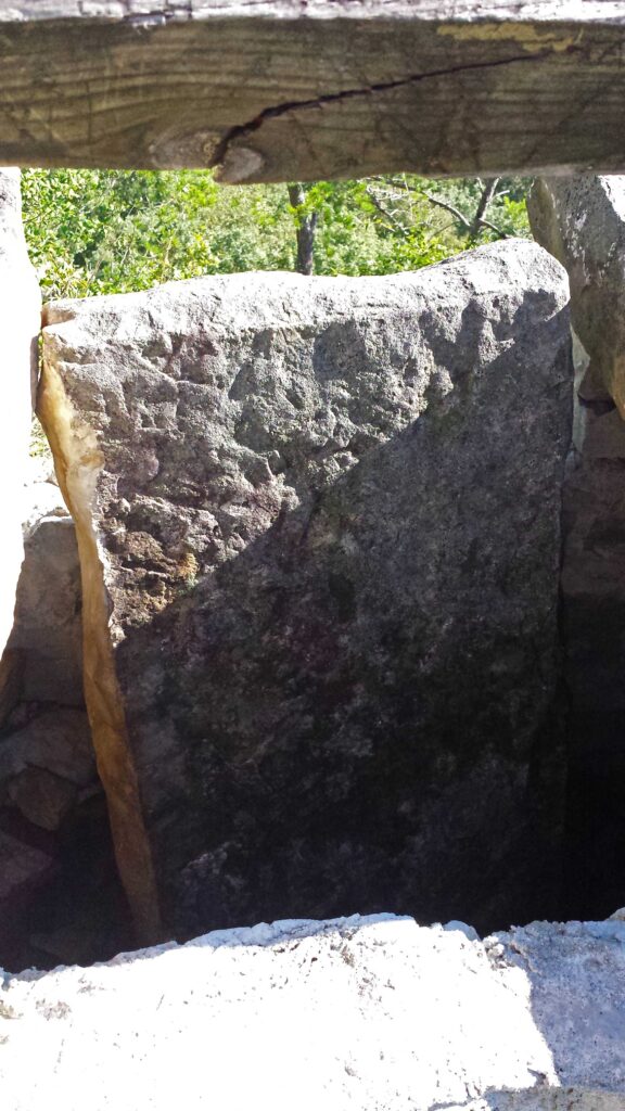
Bee Rock Overlook had been vandalized. I considered pulling the slab out of the inner wall, but it was heavy and wedged too tight.
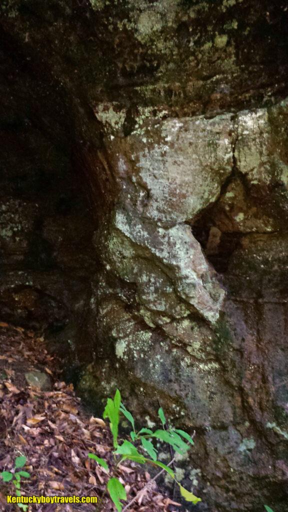
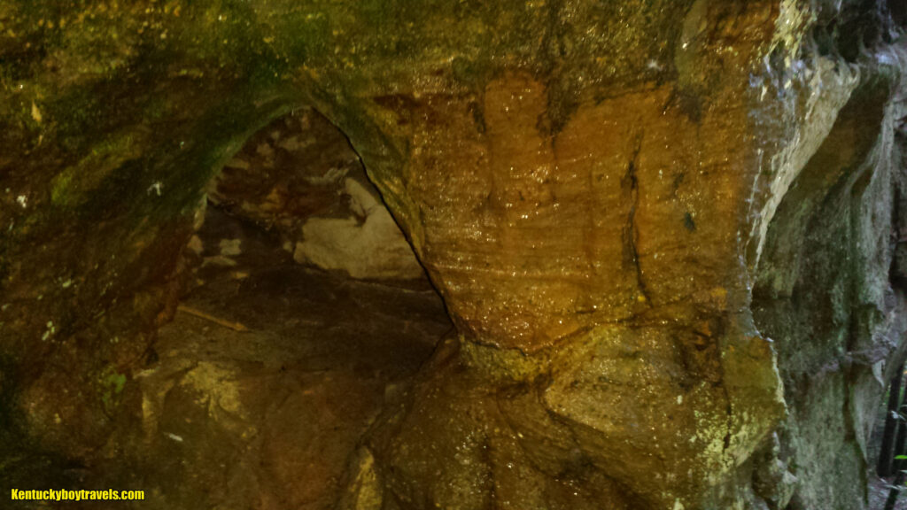
I finally photographed the small arch located a few hundred yards from Waterfall #3. I procrastinated for years due to its inaccessibility, and frankly it is not very impressive. My standard for whether or not an arch is big enough to count is my six foot, 170 pound body must fit through it – walking, stooping or crawling. That standard is debatable here, but I will violate my own rules just this time! I hereby dub it Bee Rock Loop Arch.
The roar of Waterfall #4 beckoned me. I climbed the steep hill, hopping boulders and battling thickets. The waterfall was beautiful; it produced no rainbow on this overcast day, but the sun’s beams glimmered in the mist.
I left Bee Rock and journeyed to Junior’s house to watch Youtube videos, hang out with the cats and converse late into the night. Shannon cooked me a marvelous dish. My right ankle started inching when I drove home. It was covered with chigger bites, but my left ankle had somehow eluded them. If I had absolute power, I would wage bugocide against parasites. Such a campaign would fail, of course. They will be here long after humans are gone.
Added 11/30/14 – Updated 7/26/26